$31.95 Original price was: $31.95.$22.37Current price is: $22.37.
SKU: D2VZD 50034 Categories: Accessories, Gift Ideas
- Protect Your Information, Shop with Safe Payments
- Made of environmentally friendly materials
- Shop with confidence, enjoy free returns.
- Quality products for every lifestyle.

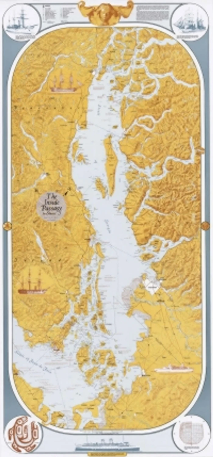
This richly colored and illuminated map covers from Stuart Island — just north of Desolation Sound, British Columbia — to Port Townsend, Washington, and as far west as Port Angeles in Washington, and Sooke Harbor on Vancouver Island. All of Georgia Strait, and the Gulf and San Juan Islands are included, as well much of the Strait of Juan de Fuca.
SPECS
-
- Dimensions: 27″x 58″
Be the first to review “Inside Passage Art Map” Cancel reply
Related products
Sale!
Accessories
Sale!
Accessories
Sale!
Accessories
Sale!
Accessories
Sale!
Accessories
Sale!
Accessories
Sale!
Accessories
Sale!
Accessories



Reviews
There are no reviews yet.